


-
-
About the District
Overview of the District
History and tradition
Geographical and Economic
-
Administration
Deputy Commissioner
Deputy Commissioner\'s Office
Section Related
Important Information
Additional Deputy Commissioners
-
Deputy Director (Deputy Secretary) Local Government Division
-
Additional Deputy Commissioner (General) and (Deputy Director, Local Government Department)
-
Additional Deputy Commissioner (Education and ICT)
-
Additional deputy commissioner (Revenue)
-
Additional District Magistrate
-
Additional Deputy Commissioner (Development and Human Resource Management)
Officers and Employees
Others
-
Deputy Director (Deputy Secretary) Local Government Division
-
Government office
Law-discipline and security issues
Education and Culture
Agriculture and food related issues
-
বাংলাদেশ কৃষি উন্নয়ন কর্পোরেশন (বিএডিসি )
-
Office of the District Bazar Officer
-
District Food Controller\'s Office
-
Bangladesh Safe Food Authority Faridpur
-
Department of Agricultural Extension
-
District Livestock Office
-
District Fisheries Officer (DFO) office
-
জেলা কৃত্রিম প্রজনন কেন্দ্র, ফরিদপুর
-
মূখ্য পরিদর্শকের কার্যালয়, পাট অধিদপ্তর
-
Soil Resourse development Institute
-
Assistant Director Office, Dept Of Jute , Faridpur
-
Bangladesh Agricultural Development Corporation (BADC), Irrigation Division, Faridpur
-
Spices Research Sub-Centre, BARI, Faridpur
-
On Farm Research Division, BARI, Faridpur
-
Fisheries Training & Extension Center, Faridpur
-
District Seed Certification Office, Faridpur.
Health related
Engineering and communication
-
Water Development Board (Executive Engineer\'s Office)
-
Directorate of Information and Communication Technology
-
Local Government Engineering Department
-
FFICE OF THE DEPUTY POSTMATER GENERAL, FARIDPUR DIVISION, FARIDPUR.
-
Bangladesh Postal Department, Faridpur
-
Department of Public Health Engineering
-
Department of Health Engineering
-
Education Engineering Department
-
Road and Highways Department
-
BRTA office
-
Public Works Department
-
BTCL
-
Sales and Distribution Division-1, wzpdcl, Faridpur
-
Sales and Distribution Division-2, WZPDCL, Faridpur
About Human Resources Development
-
District Employment and Manpower Office
-
Office of the District Co-operative Officer
-
PDBF
-
Protibondhi Seba O Sahajjo Kendro, Faridpur
-
Bangladesh Computer Council
-
Bangladesh Rural Development Board
-
District Women Affairs Office
-
District Social Welfare Office
-
District Statistics Office
-
Department of Youth Development
-
District Savings Office
-
Jatyo Mohila Sangstha, District Office, Faridpur
-
Islamic Faundation
Other Offices
-
Bangladesh House Building Finance Corporation
-
Hospital Social Service Program, Bangabandhu Sheikh Mujib Medical College, Faridpur
-
bscic
-
Regional Labour Office, Faridpur
-
■বাংলাদেশ ক্ষুদ্র ও কুটির শিল্প করপোরেশন (বিসিক)
-
Department of Insfection of Factories & Stablesment
-
■ফরিদপুর পল্লী বিদ্যুৎ সমিতি
-
■জেলা রেজিস্ট্রারের কার্যালয়
-
■জোনাল সেটেলমেন্ট অফিস
-
Small Farmer Development Foundation, Regional Office, Faridpur
-
■কর কমিশনারের কার্যালয়
-
■District Accounts and Finance Office, Faridpur
-
■নদী গবেষা ইনষ্টিটিউট
-
Soil Resource Development Institute, Regional Laboratory, Faridpur
-
■জেলা তথ্য অফিস
-
■বন বিভাগ
-
District Veterinary Hospital,Faridpur
-
Office of the Chief Engineer, Western Zone
-
Office of The Superintending Engineer, BWDB
-
বাংলাদেশ কৃষি উন্নয়ন কর্পোরেশন (বিএডিসি )
- Local Government
-
Other Organizations
Educational Institution
Organization / Organization
- Gallery
-
Circuit House, Faridpur
মেনু নির্বাচন করুন
-
-
About the District
Overview of the District
History and tradition
Geographical and Economic
-
Administration
Deputy Commissioner
Deputy Commissioner\'s Office
Section Related
Important Information
Additional Deputy Commissioners
- Deputy Director (Deputy Secretary) Local Government Division
- Additional Deputy Commissioner (General) and (Deputy Director, Local Government Department)
- Additional Deputy Commissioner (Education and ICT)
- Additional deputy commissioner (Revenue)
- Additional District Magistrate
- Additional Deputy Commissioner (Development and Human Resource Management)
Officers and Employees
Others
-
Government office
Law-discipline and security issues
Education and Culture
Agriculture and food related issues
- বাংলাদেশ কৃষি উন্নয়ন কর্পোরেশন (বিএডিসি )
- Office of the District Bazar Officer
- District Food Controller\'s Office
- Bangladesh Safe Food Authority Faridpur
- Department of Agricultural Extension
- District Livestock Office
- District Fisheries Officer (DFO) office
- জেলা কৃত্রিম প্রজনন কেন্দ্র, ফরিদপুর
- মূখ্য পরিদর্শকের কার্যালয়, পাট অধিদপ্তর
- Soil Resourse development Institute
- Assistant Director Office, Dept Of Jute , Faridpur
- Bangladesh Agricultural Development Corporation (BADC), Irrigation Division, Faridpur
- Spices Research Sub-Centre, BARI, Faridpur
- On Farm Research Division, BARI, Faridpur
- Fisheries Training & Extension Center, Faridpur
- District Seed Certification Office, Faridpur.
Health related
Engineering and communication
- Water Development Board (Executive Engineer\'s Office)
- Directorate of Information and Communication Technology
- Local Government Engineering Department
- FFICE OF THE DEPUTY POSTMATER GENERAL, FARIDPUR DIVISION, FARIDPUR.
- Bangladesh Postal Department, Faridpur
- Department of Public Health Engineering
- Department of Health Engineering
- Education Engineering Department
- Road and Highways Department
- BRTA office
- Public Works Department
- BTCL
- Sales and Distribution Division-1, wzpdcl, Faridpur
- Sales and Distribution Division-2, WZPDCL, Faridpur
About Human Resources Development
- District Employment and Manpower Office
- Office of the District Co-operative Officer
- PDBF
- Protibondhi Seba O Sahajjo Kendro, Faridpur
- Bangladesh Computer Council
- Bangladesh Rural Development Board
- District Women Affairs Office
- District Social Welfare Office
- District Statistics Office
- Department of Youth Development
- District Savings Office
- Jatyo Mohila Sangstha, District Office, Faridpur
- Islamic Faundation
Other Offices
- Bangladesh House Building Finance Corporation
- Hospital Social Service Program, Bangabandhu Sheikh Mujib Medical College, Faridpur
- bscic
- Regional Labour Office, Faridpur
- ■বাংলাদেশ ক্ষুদ্র ও কুটির শিল্প করপোরেশন (বিসিক)
- Department of Insfection of Factories & Stablesment
- ■ফরিদপুর পল্লী বিদ্যুৎ সমিতি
- ■জেলা রেজিস্ট্রারের কার্যালয়
- ■জোনাল সেটেলমেন্ট অফিস
- Small Farmer Development Foundation, Regional Office, Faridpur
- ■কর কমিশনারের কার্যালয়
- ■District Accounts and Finance Office, Faridpur
- ■নদী গবেষা ইনষ্টিটিউট
- Soil Resource Development Institute, Regional Laboratory, Faridpur
- ■জেলা তথ্য অফিস
- ■বন বিভাগ
- District Veterinary Hospital,Faridpur
- Office of the Chief Engineer, Western Zone
- Office of The Superintending Engineer, BWDB
-
Local Government
Union Parishad
District Council
-
Other Organizations
Educational Institution
Organization / Organization
-
Gallery
Photo Gallery
Videos Gallery
Education Census
-
Circuit House, Faridpur
সার্কিট হাউস - শাপলা
সার্কিট হাউজ সম্পর্কিত
সার্কিট হাউস - দোয়েল
সার্কিট হাউসের কক্ষের ভাড়া
Main Comtent Skiped
Faridpur at a glance
| A) General Information: | |||
| 1 | Name of the district | : | Faridpur |
| 2 | District size | : | 2072.72 sq km |
| 3 | Geographical location | : | Faridpur district is located at 89.290 East to 90.110 East longitude and 23.160 North to 23.400 North latitude. |
| 4 | Boundaries | : | Rajbari and Manikganj districts on the north, Gopalganj district on the south, Magura and Narail districts on the west and Madaripur and Munshiganj districts on the east. |
| 5 | Number of people | : | 19,12,989 (according to 2011 census) a) Male - 9,63,529 b) Female - 9,49,440 |
| 6 | Population density | : | 920 per sq. Km |
| 7 | Number and name of upazila | : | 9 (nine) t. Sadar, Madhukhali, Boalmar Alfadanga, Saltha, Nagarkanda, Bhanga, Sadarpur and Charbhadrasan |
| 8 | Area and population of the upazila | : | |
| Name of the upazila | Volume | Number of people | |
| Faridpur Sadar | 406.02 left | 4,13,475 | |
| Madhukhali | 230.20 '' | 1,8,75 | |
| Boalmari | 262.34 '' | 2,33,63 | |
| Alfadanga | 136.00 '' | 1,00,596 | |
| Saltha | 165.11 '' | 1,46,60 | |
| Nagarkanda | 193.91 '' | 1,60,7 | |
| Bhanga | 216.34 '' | 2,32,38 | |
| Sadarpur | 290.21 '' | 1,8,758 | |
| Charabhadrasana | 141.59 '' | 6.36 | |
| 9 | Number and name of the police station | : | 9 (nine) t. Kotwali, Madhukhali, Boalmari, Lafadanga, Saltha, Nagarkanda, Bhanga, Sadarpur and Charbhadrasan. |
| 10 | Number and name of municipality | : | 5 (five) t. Faridpur, Boalmari, Nagarkanda Ovanga, Madhukhali. |
| 11 | Number of unions | : | 61 |
| 12 | Number of villages | : | 1,6 |
| : | |||
| B) Educational Institutions: | |||
| 1 | Number and name of government colleges | : | 8 (seven) T. Rajendra College, Yasin College, Sarada Sundari Mahila College, Charbhadrasan College, Madhukhali College, Sadarpur College, Boalmari College. |
| 2 | Number of private colleges | : | 24 (twenty four) t. |
| 3 | Number and name of government high schools | : | ৬ (Six) T. Faridpur District School, Faridpur Government Girls High School, Bishwa Jaker Manzil High School, Boalmari Girls High School, Kamarkhali Girls High School, Charbhadrasan Girls High School. |
| 4 | Private high school | : | 189 |
| 5 | Junior High School | : | 52 |
| 6 | Dakhil Madrasa | : | 32 |
| 7 | Alim Madrasa | : | 10 |
| 8 | Fazil Madrasa | : | 09 |
| 9 | Kamil Madrasa | : | 01 (Bishwa Jaker Manzil, Sadarpur). |
| 10 | Private Ebatedai Madrasa | : | 6 |
| 11 | Government primary school | : | 543 |
| 12 | Private primary school | : | 218 |
| 13 | Unregistered primary school | : | 22 |
| 14 | Education rate | : | 43.95% |
| C) Technical educational institutions: | |||
| 1 | Medical College | : | 01 |
| 2 | Teachers Training College | : | 01 |
| 3 | Government Commercial College | : | 01 |
| 4 | Polytechnic Institute | : | 01 |
| 5 | Agricultural Institute | : | 01 |
| 6 | P.T. I. | : | 01 |
| 7 | Technical Training Center | : | 01 |
| 8 | Homeopathy Medical College | : | 01 |
| 9 | School for the Deaf and Dumb | : | 01 |
| D) National Institution: | |||
| 1 | Bangladesh River Research Institute | : | 01 |
| 2 | Fisheries Development Training Center | : | 01 |
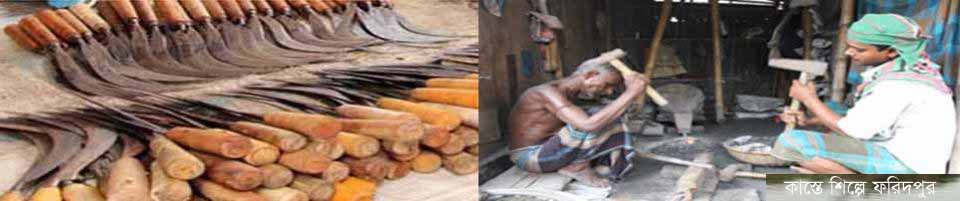
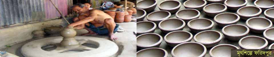
| E) Industrial establishments: | |||
| 1 | Sugar mill | : | 01 |
| 2 | Jute mill | : | 04 |
| 3 | Textile mill | : | 02 |
| 4 | Pipe factory | : | 01 |
| 5 | Weaving industry | : | 202 |
| F) Health issues: | |||
| 1 | Medical College Hospital | : | 01 |
| 2 | General Hospital | : | 01 |
| 3 | Number of Upazila Health Complex | : | 06 |
| 4 | Number of Union Health Complex | : | 36 |
| 5 | Number of Union Health Complex | : | 43 |
| G) Communication matters: | |||
| 1 | Length of paved road | : | 96.7 km |
| 2 | Raw road length | : | 2,751.00 km |
| 3 | HBB road length | : | 338.6 km |
| 4 | Number of bridges / culverts | : | 1,621. |
| 5 | Length of bridge / culvert | : | 20,908.03 m. |
| H) Other information: | |||
| 1 | Food warehouse | : | 30 |
| 2 | Mosque | : | 3,242 |
| 3 | Temple | : | 482 |
| 4 | Churches | : | 03 |
| 5 | Postal bungalow | : | 09 |
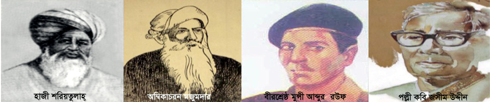
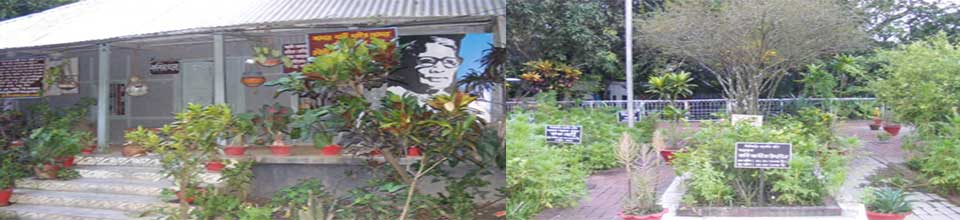
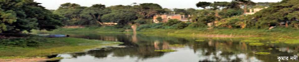
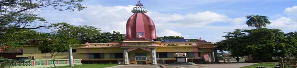
| I) Places of interest: The house and tomb of the rural poet Jasim Uddin. River Research Institute. Hazrat Shah Farid Mosque. Ashram of Jagadbandhu Sundar. Gaur Gopal Angina, Goalchamat. Atarshi Bishwa Jaker Manzil, Sadarpur. Baish Rashi Zamindar Bari, Sadarpur Satair Mosque, Boalmari. Deul of Mathurapur, Madhukhali. Patrail Mosque, Bhanga. |
|||


Site was last updated:
2025-07-08 11:21:58
Planning and Implementation: Cabinet Division, A2I, BCC, DoICT and BASIS
Technical Assistance:
![]()
Developed By: